


NASA offers a free service of good quality and up-to-date DEM files
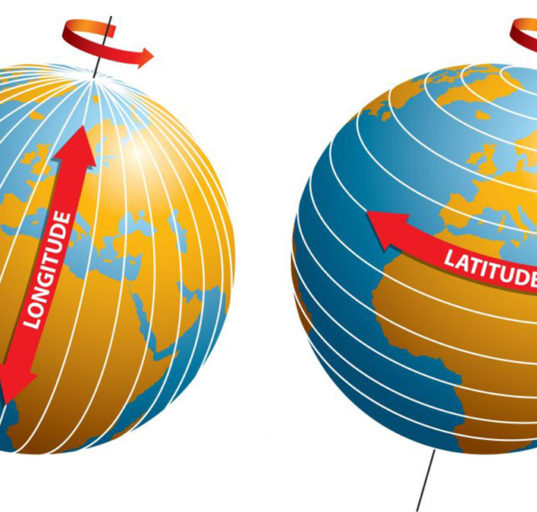
What is a digital elevation model (DEM)?
USGS
A Digital Elevation Model (DEM) is a representation of the bare ground (bare earth) topographic surface of the Earth excluding trees, buildings, and any other surface objects.
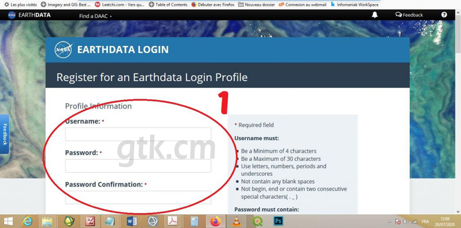
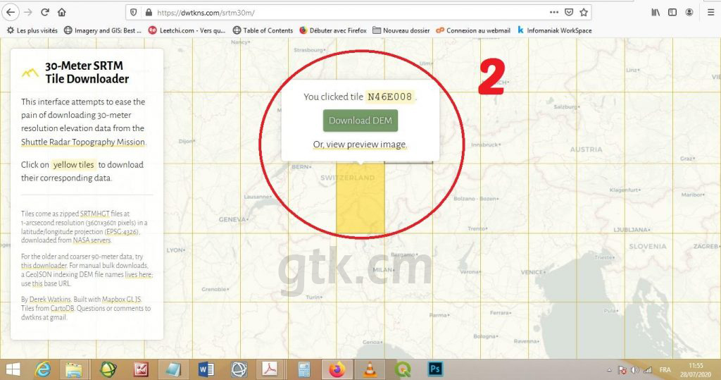
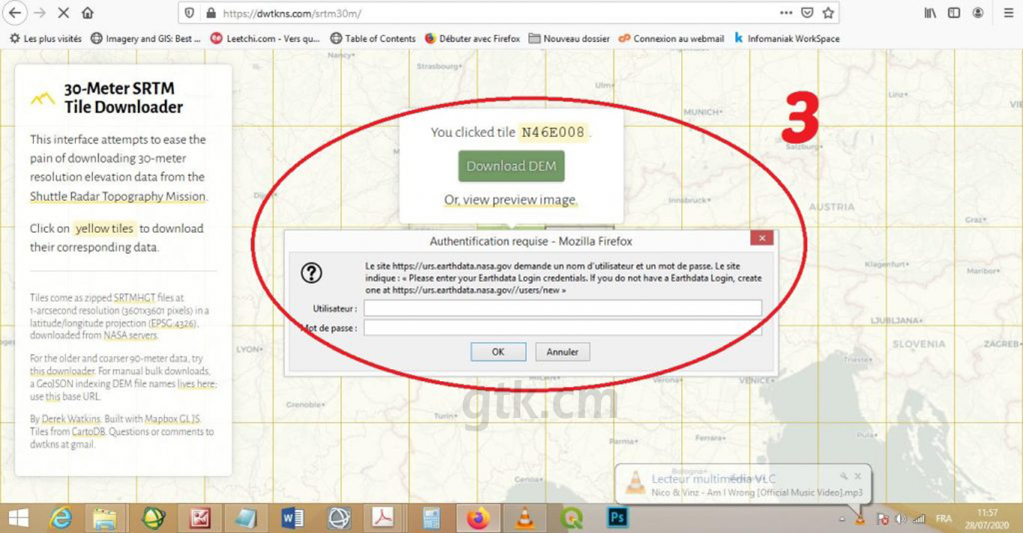
To get your Digital Elevation Model (DEM) files, I suggest the link dtwkns.com/srtm30. The interface of this site is based on one of the sub site of NASA, Earthdata. You must first open an account. Then you return to the dtwkns site to locate your study area, once your area is selected, download the file by entering your login and password created earlier.
- Create an account on https://urs.earthdata.nasa.gov//users/new
- Then go back to https://dwtkns.com/srtm30m/ to locate your work area
- Enter your Earthdata ID to get your file
The files proposed by this service have a spatial resolution of 30 meters (1 arc-second for global coverage)
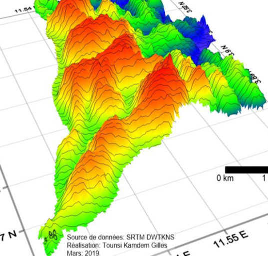
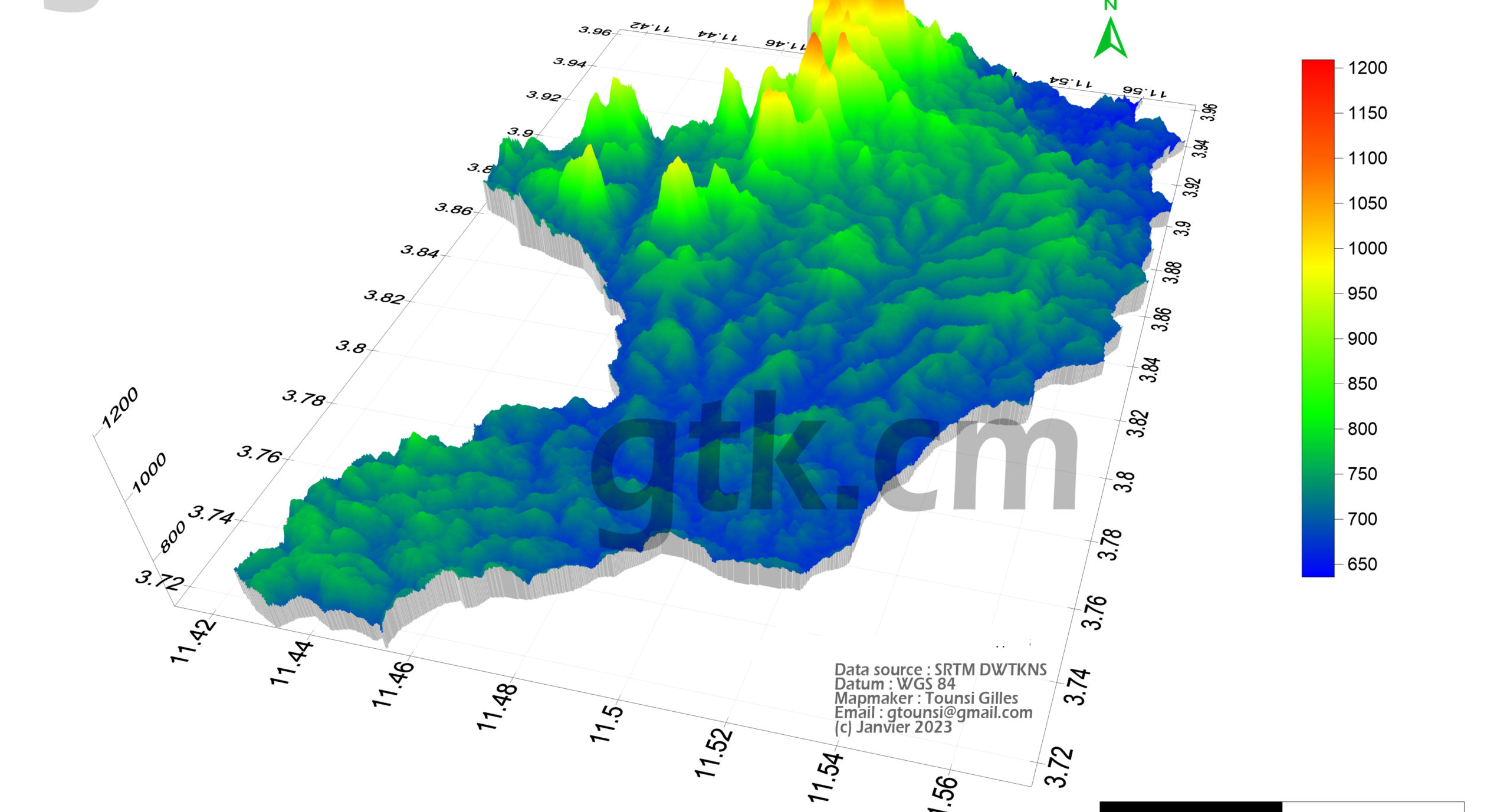
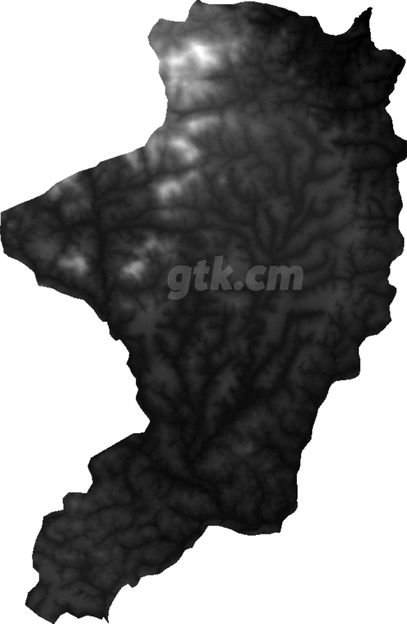
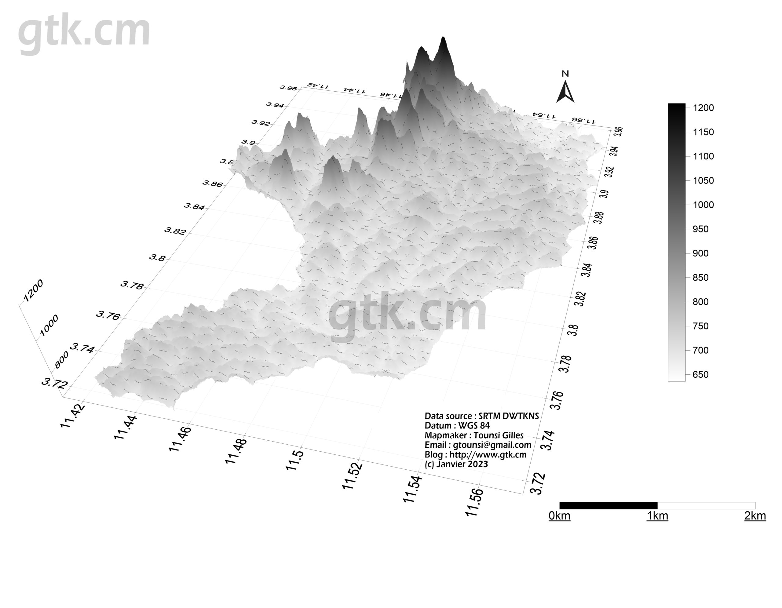
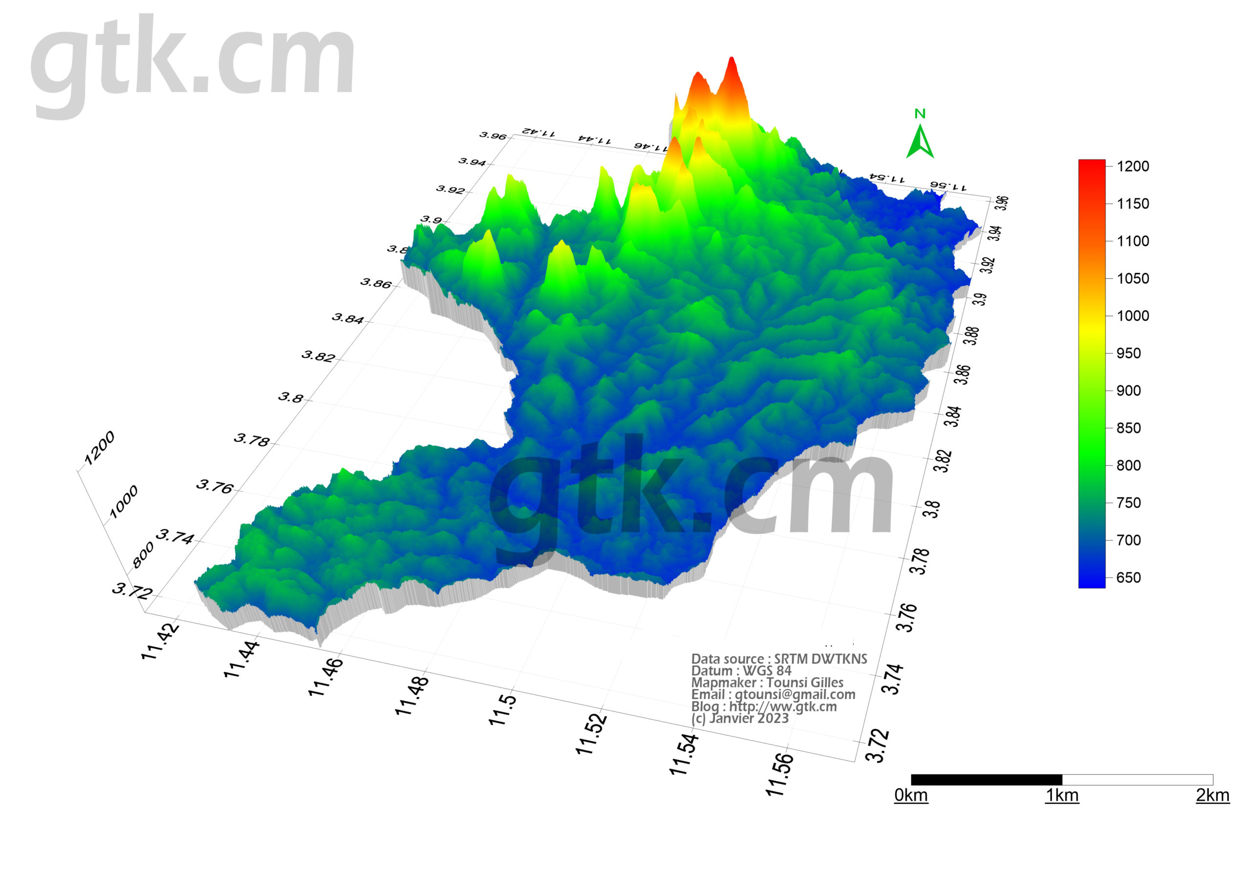
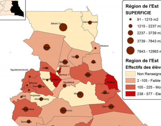
After downloading and processing your study area, we get this :

1 Comment