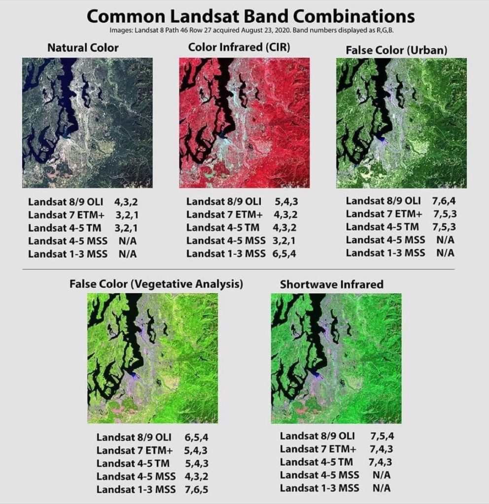


From natural colors to Shortwave Infrared
Landsat until today with Landsat 9 has seen a generation of sensors for the acquisition of various objects on the surface of the earth. These sensors carry out the activities of the Landsat program in operation since 1972 with Landsat 1. Each satellite carries a sensor with different characteristics and specific missions. Thus, the monitoring activity ensures the monitoring of vegetation, including urban dynamics. Multispectral bands are used to detect and display the desired phenomena.
Landsat 1 Sensor MSS
Landsat 2 Sensor MSS
Landsat 3 Sensor MSS
Landsat 4 Sensors MSS et TM
Landsat 5 Sensors MSS et TM – (MultiSpectral Scanner) – (Thematic Mapper)
Landsat 6 —-
Landsat 7 Sensors ETM+ – (Enhanced Thematic Mapper Plus)
Landsat 8 : OLI1 & TIRS 1 – (Operationnal Land Imager) – (Thermal InfraRed Sensor)
Landsat 9 : OLI 2 & TIRS 2 – (Operationnal Land Imager) – (Thermal InfraRed Sensor)