


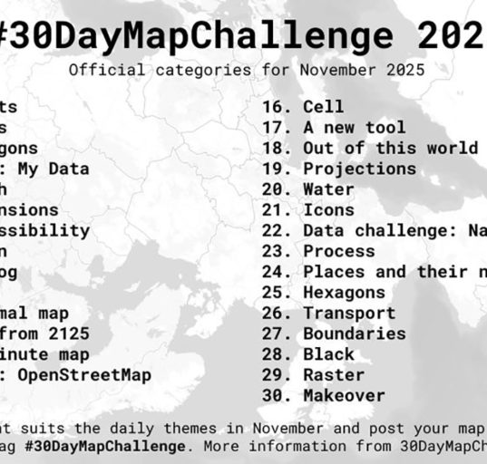
Common Landsat Bands combinations
From natural colors to Shortwave Infrared Landsat until today with Landsat 9 has seen a generation of sensors for the


From natural colors to Shortwave Infrared Landsat until today with Landsat 9 has seen a generation of sensors for the
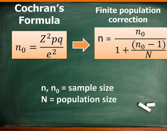
Using published tables for sampling We can enumarate four strategies for calculating sampling size: Census for small populations, sample size
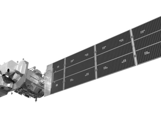
Landsat 9 was launched on Monday, Sept. 27, 2021 from Vandenberg Space Force Base in California. Landsat 9 is a
Quels sont les préréquis pour être éligible à la monétisation avec Youtube? Youtube met à la disposition des créateurs de
Details about the OLI-2 and TIRS-2 spectral bands Landsat 9 launched on September 27, 2021. It’s a replication of Landsat
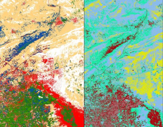
Supervised and unsupervised classification are two common methods used in GIS for analyzing and categorizing spatial data. Here’s a breakdown
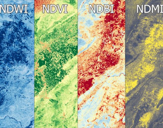
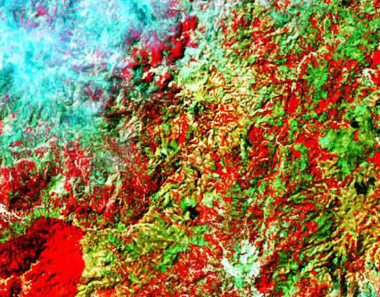
NDVI, NDBI, NDWI, and NDMI are all indices that are commonly used in remote sensing and GIS applications to analyze
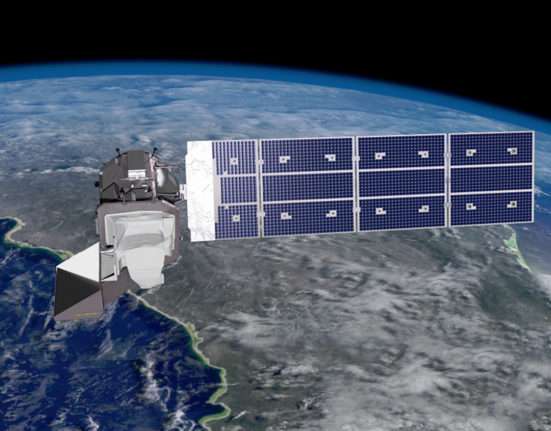
The combined Landsat 8 + Landsat 9 collect data every 8 days Landsat 9 was successfully launched on Monday, Sept.
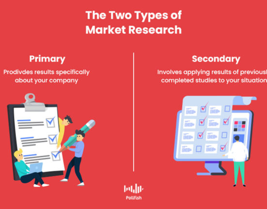
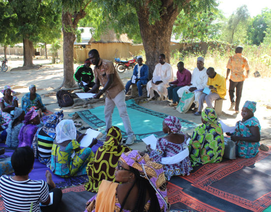
Another reflexion about data collect methodology Primary source data belongs to the present. Secondary source data belongs to the past.
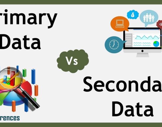
A little exercise to see the difference between these two types of data sources. Depending on what we are looking
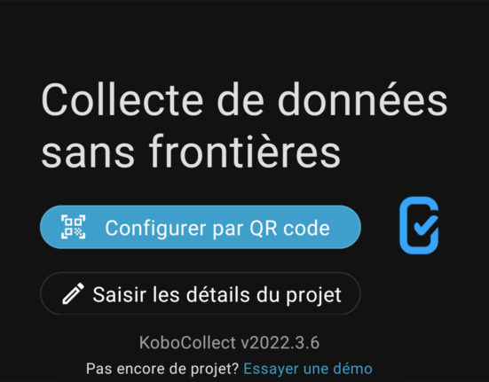
This option solves the issue of interoperability between different operating systems. Once we have finished designing a data form with
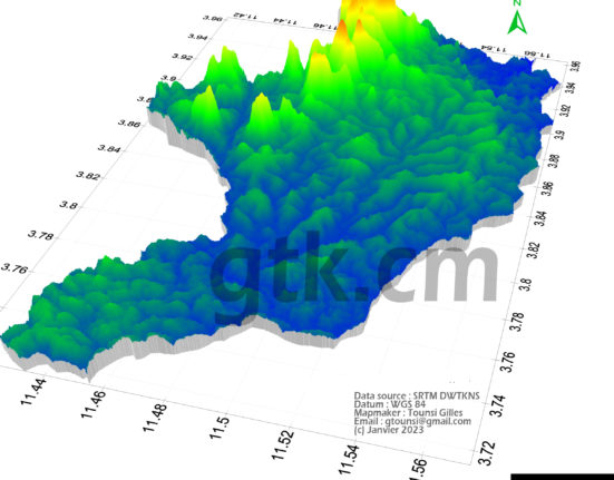
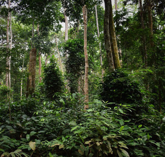
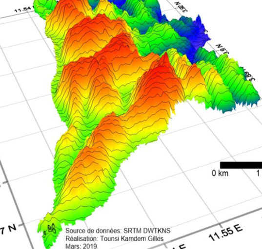
NASA offers a free service of good quality and up-to-date DEM files What is a digital elevation model (DEM)?A Digital

Les considérations traditionnelles demeurent des freins à l’accès à la propriété foncière pour la femme « Genre et foncier :
La recherche par la méthode qualitative possède des fonctionnalités différente de la recherche quantitative. Parmi l’une d’elle, il y a
You cannot copy content of this page / Veuillez saisir ce que vous souhaitez copier.