


…Comparatif de l’infrastructure nationale de données géospatiales et du Cadre intégré d’information géospatiale
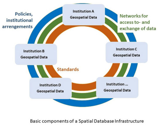
… l’infrastructure nationale de données géospatiales d’un pays peut généralement se définir comme un cadre de politiques, de normes, de

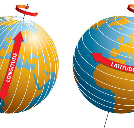
… l’infrastructure nationale de données géospatiales d’un pays peut généralement se définir comme un cadre de politiques, de normes, de
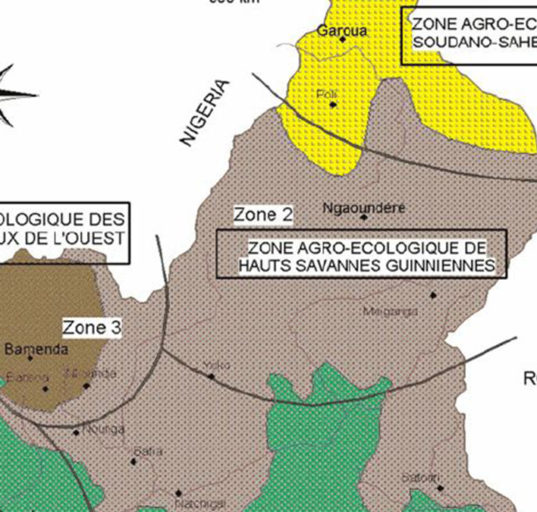
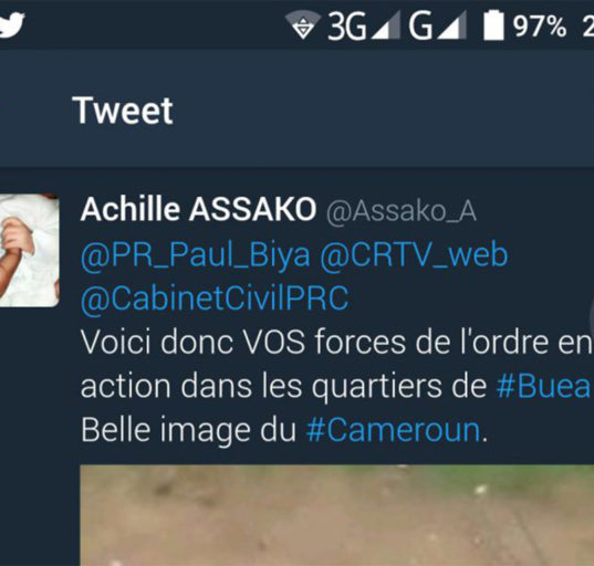
High level forum on global geospatial Management Information. Seoul, Republic of Korea, 24-26 October 2011 In Cameroon, there is currently

Un Ph.D ou un doctorat professionnel permet d’acquérir différents types d’expertise. Si vous envisagez de poursuivre des études de doctorat,
Forum de haut niveau sur les informations de gestion géospatiale mondiale. Séoul, République de Corée, 24-26 octobre 2011 Au Cameroun,
From natural colors to Shortwave Infrared Landsat until today with Landsat 9 has seen a generation of sensors for the
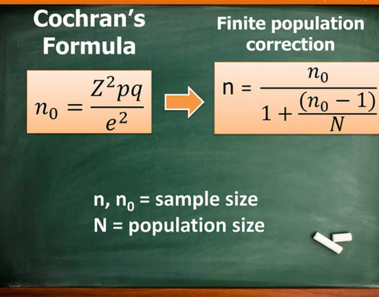
Using published tables for sampling We can enumarate four strategies for calculating sampling size: Census for small populations, sample size
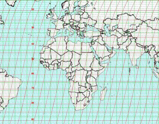
Landsat 9 was launched on Monday, Sept. 27, 2021 from Vandenberg Space Force Base in California. Landsat 9 is a
Quels sont les préréquis pour être éligible à la monétisation avec Youtube? Youtube met à la disposition des créateurs de
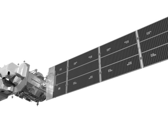
Details about the OLI-2 and TIRS-2 spectral bands Landsat 9 launched on September 27, 2021. It’s a replication of Landsat
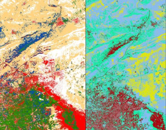
Supervised and unsupervised classification are two common methods used in GIS for analyzing and categorizing spatial data. Here’s a breakdown
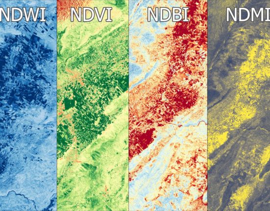
NDVI, NDBI, NDWI, and NDMI are all indices that are commonly used in remote sensing and GIS applications to analyze
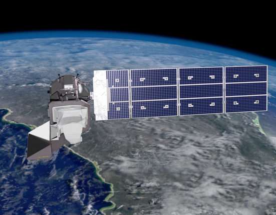
The combined Landsat 8 + Landsat 9 collect data every 8 days Landsat 9 was successfully launched on Monday, Sept.
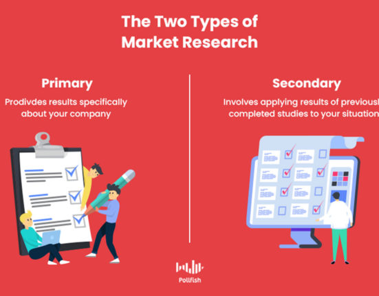
Another reflexion about data collect methodology Primary source data belongs to the present. Secondary source data belongs to the past.
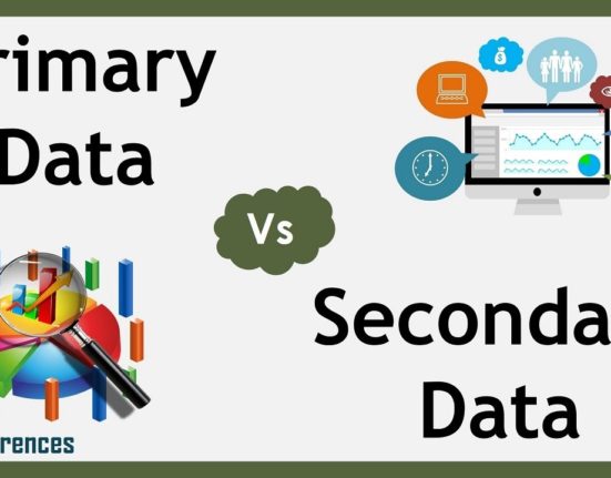
A little exercise to see the difference between these two types of data sources. Depending on what we are looking
You cannot copy content of this page / Veuillez saisir ce que vous souhaitez copier.